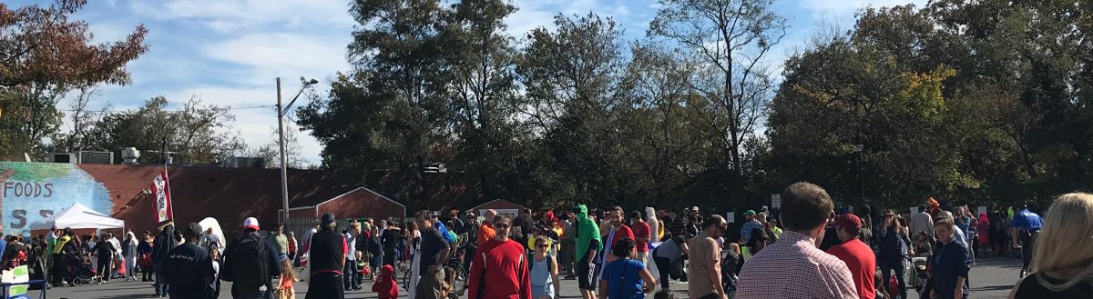
A large group of neighbors and activists, Junction shoppers and business owners, along with City Councilmember Jarrett Smith, sent this letter on racial equity this week to the County staff who are currently evaluating the proposed development at Takoma Junction. Community Vision for Takoma stands with this group of over 100 people who are urging the County to analyze the effect of the proposed development on racial equity at the Junction.
If you want to add your voice to these concerns, please send an email to Elza Hisel-McCoy, Montgomery Planning Board, at <elza.hisel-mccoy@montgomeryplanning.org> and simply say you join with others in the community of Takoma Park who are concerned about the racial equity and social justice impacts of the proposed development.
Original concept submitted by NDC with truck parked in loading zone at rear. City chose NDC based on their proposal including this plan.
It may be hard to see the full arc of the proposed Takoma Junction development process, a process unfolding over many years now. So here, we provide a preliminary timeline of events with linked documents, over the past 30 years.
1992. Takoma Park Historic District, including the Junction, established to protect against “unsympathetic alteration and insensitive redevelopment.”
1995. After residents “violently opposed” a proposed chain drug store on the empty Takoma Junction lot and express desire for a grocery store, City buys lot, hoping to attract Co-op to Junction.
1998. Co-op moves to Junction. City begins renting a portion of lot to Co-op for parking, storage, and loading. Co-op begins sponsoring public use, eventually including Earth Day, movie screenings, weekly concerts, and in the pandemic, hands-free grocery pickup, Farmer’s Market, non-profit food distribution, and Black Lives Matter protest.
2009. Independent study commissioned by Old Town Business Association (OTBA) identifies Co-op as the Junction anchor, recommends “every effort be made to encourage” its further development, and recommends 10,000 sf expansion of Co-op and addition of Co-op cafe.
2011. Co-op membership votes to authorize Co-op Board to pursue expansion.
Feb 2012. Takoma Junction Task Force Report issued. Mentions community desire for small town charm, food trucks, expanded community use, pavilion, playground, support for local businesses.
Jan 2014. Under a short-lived City Manager who now works for Amazon, City puts out Request for Proposals, effectively pre-ordaining choice of a commercial developer and excluding Co-op’s expansion and open public space proposal. City Councilman Seth Grimes later laments, “The city made a mistake in not providing detailed, clear guidance on community preferences” and that “none of the proposals” meet City needs documented by Junction Task Force.
Sept 5 2014. The city chooses four finalists, excluding the Co-op.
Nov 14 2014. More than 90 people sign up and more than 70 people show up for the first Community Vision for Takoma town hall, on the Junction plans. Presentations are made by Co-op board members and their hired development consultant, and by a member of the Takoma Junction Task Force.
March 2015. City chooses Neighborhood Development Company (NDC), based on their concept showing residential and commercial, a loading zone behind the building (no lay-by) and presumed expansion of Co-op as the anchor tenant.
March 2015. City Councilman Tim Male opines that plan is too big, says, “I have a hard time imagining…a 33,000 square foot building…on that spot.” City Councilmember Seth Grimes writes a blog post about why he chose NDC, citing the lack of layby in their design, among other elements. He notes that a lay-by would be a “step in the wrong direction,” and that the “co-op has said this approach would be unworkable.”
July 20 2016. City announces a short-lived (less than a year) community advisory committee. NDC presents a (short-lived) “public market” concept, showing a photo of Union Market. In public comments, Co-op board president indicates a “lay-by” has been added in a new design they were given by NDC in June 2016. Residents express concern, including Marc Elrich who says “I’ve seen how things morph,” stresses the importance of the Co-op, the difficulty of the site, and the need to negotiate a clause for an exit from the agreement without penalty. He notes, “I’d hate to see you all lose money trying to extricate yourselves from this deal.” Fire Chief Tom Musgrove expresses concern about safety of the lay-by and what could become his “inability to come out and provide the necessary protection” to residents.
July 27 2016. City signs a Development Agreement with NDC, laying groundwork for choosing new anchor tenant if they cannot agree with Co-op on expansion.
July 2016. First of at least three petitions opposing the development. Over 1300 unique signatures gathered by 2018. Majority of public comments oppose plan at numerous City Council meetings over multiple years. City refuses to survey residents or hold referendum to document opposition.
January 11 2017. NDC and Co-op fail to reach agreement for Co-op expansion as anchor tenant. City authorizes NDC to seek a new anchor tenant.
2017. NDC makes deal to acquire adjoining auto clinic, increases plan to over 50,000 sq ft of offices, retail, and restaurants (no housing). They do not use that “new” space to add any public use back in. The loading zone remains on Carroll (the state highway) as a lay-by lane. Three-story glass design received as “Bethesda style.”
April 2018. Community Vision hosts a packed Town Hall with State Highway Administration. Residents and Fire Chief express concerns about safety and traffic issues created by plan.
April 2018. NDC submits revised plans with funkier facade but maintaining 50,000 sf size. Images portrayed from a high vantage point continue to minimize perceived size of development.
May 2018. NDC and Co-op, unable to reach a plan for Co-op accommodation during and after construction, agree to mediation funded by City.
May 2018. The majority of businesses in the Junction sign a letter expressing concern about the development, and noting that there has recently been a “promising upswing” in businesses there, but that they depend on the parking in the lot. Developer makes no promises about the number or cost of parking slots that would be available to the public in the proposed garage.
June 8 2018. The City ends their license agreement with the Co-op to use the parking lot for deliveries and parking.
June 2018. Two Junction traffic studies issued. They find multiple problems: new traffic will create a “failed intersection,” road reconfiguration will induce demand and create more congestion.
Sept 2018.Ground lease goes into effect. NDC begins paying rent to City. Co-op begins paying more to NDC to sublet the lot than NDC is paying the City. So, NDC is now making money on the lot every month. City is now getting less per month from NDC than they got directly from Co-op to rent just part of the lot. Nevertheless, the Co-op begins providing free parking for the whole Junction on the lot they are paying for.
Oct 2018. NDC abruptly shuts down block of small businesses on a block they plan to develop in Deanwood, in Northeast DC. BlackLivesMatterDC leads protest march to home of NDC’s owner. Civil rights lawyer represents businesses against developer.
Oct 2018. Mediation between NDC and Co-op concludes. Co-op prohibited from any further protest or critique of the project, in return for ability to continue to rent lot from NDC until construction, and other accommodations. The prohibition against the Co-op voicing any critique of the project remains in effect for the next five years.
Feb 2019. After failing to convince surrounding businesses to sell them “transferrable development rights,” NDC is forced to reduce plan size by more than 10,000 sq ft to attempt to comply with zoning. NDC submits plan to County.
March 2019. First review by County’s Development Review Committee (DRC) finds lay-by unacceptable and says it “should be removed,” and finds planned location of exit onto Carroll unsafe, inadequate emergency access, plan is bad for walkers and bikers and public transit, and other issues.
2019. NDC has three Preliminary Consultations with County’s Historic Preservation Commission (HPC). In May and August, staff and Commissioners critique size, shape, lay-by, public space, public input, tree loss. Mayor, City Manager push back. HPC backs off, but asks NDC to return with depictions of Columbia (“rear”) facade. NDC chooses to ignore this request.
Presentation to HPC, October 2019. Private balcony added. “Rear” facade pushed out toward Columbia. Note how small the Co-op (grey roof) still looks next to the development.
2019 All but one retail spaces in Junction currently rented, and public parking lot is frequently full now, undercutting City’s original stated intention to “revitalize the Junction” with a large development. Developer persists in referring to it as a “vacant lot.”
Nov 2019 NDC asks for a second 3-month extension to July 2020 for responding to the DRC’s comments, because they are waiting for the SHA’s Junction Vision Study on roadways and traffic.
January 9 2020 Montgomery County Planning Board votes to approve NDC’s extension to Sept 30 2020 instead of July, since the Planning Board will be out of session for the summer in July 2020.
Spring 2020 The COVID-19 pandemic hits. Co-op receives national acclaim for protecting workers while remaining in operation. The entire Co-op staff keeps their union jobs. Both lots begin to be used intensively for food packing and distribution by local non-profits.
May 8 2020 State Highway Administration releases a letter to the NDC’s traffic consultant, stating that four different SHA departments have reviewed the project and that the development would increase traffic, cannot be built without reconfiguration of Junction roadways, and there is no state money for reconfiguration through 2025. It also questions many other aspects of the plan.
May-July 2020 Residents get wind of backroom negotiations by the City to try to figure out some other way to accommodate the Junction development. Resident Andrew Strongin asks to see communications on this topic for the six-week period after the SHA’s May 8th letter. The City Attorney writes back that there are indeed over 200 communications on the Junction in this period, but that it will cost $985 to have him review and possibly redact the documents (due to “attorney-client privilege” or “executive privilege). A GoFundMe campaign raises the funds in a matter of hours, due to public outcry. The City drops the fee, and releases the documents. A text from the Mayor attempting to pressure the SHA is revealed.
July 2020 At a series of City Council meetings, residents request that the City re-evaluate the Junction plan for a retail and office development in light of the pandemic, the recession, Black Lives Matter, and the climate crisis. The City declines, saying they will look at and vote on the plan only immediately prior to the final Planning Board vote.
July 20 2020 Developer submits to the County’s DRC the revised Junction plans (here and here) responding to the March 2019 DRC comments. This sets in motion deadlines leading to the final County vote. New drawings finally depict the Columbia/Poplar facade, leading to public outcry:
High vantage point minimizes mass.Reddish building on right is Co-op.
August 2020 Under persistent pressure by attorney and resident Andrew Strongin, the City acknowledges three documents that were not originally posted anywhere. One is a July 14th response from the developer’s traffic group to the SHA, stating that they are assuming in their plans that the C0-op’s entrance from 410 will be closed, and all entrance and exit to and from the Co-op’s Sycamore lot will be from Sycamore.
August 2020 Despite the fact that the City refused to hold work sessions on the plans, and that questions about the plan have gone unanswered, Councilmember Kacy Kostiuk arranges two zoom meeting with one neighborhood of her ward, with the Mayor, and City and County staff, to “listen to” neighbors angry about the effect of the proposed development on Columbia Ave. The rest of the City is not invited to these meetings. Questions are collected. It becomes apparent that the developer cannot, in fact, legally force the closure of the Co-op’s entrance from 410.
August 2020 The City posts a false description of the process, urging people to wait to weigh in with the County until later in the process, even though the County staff very clearly urged residents to weigh in now, or it will be too late. The City also falsely states that SHA has not weighed in, when SHA has already documented serious issues with the project.
August 2020 Over 100 people, including City Councilman Jarrett Smith and Junction business owners, sign a letter urging the County to consider the racial equity and social justice impacts of the proposed development. The letter states, “…we ask that you do what the City of Takoma Park has not: cast a critical eye on a proposal that threatens the destruction of a racial minority-majority business community…”
November 6 2020 and January 15 2021 The developer submits to the County what is believed to be the final revisions of the plans, comprising over 50 documents. (Search for those dates HERE and HERE). The bike share is moved to BY Morrison Park (“the triangle”), reducing small public space there. The bus stop is placed in the “public space” in front of the development (but is not depicted in the 3D renderings).
Driveway into the garage, next to “public space.” Bus stop not pictured. Balcony is for private use.Columbia side, “trees not shown for clarity of building facade.” No public use of balcony, terrace, roof.
December 2020 County responds to the November 2020 plans HERE. Recommendation is made for right-turn only going into or out of the garage/driveway onto Carroll Ave, diverting traffic onto residential side streets, including the curvy Columbia Ave, and encouraging U-turns.
December 31, 2020 The State Highway Administration (SHA) releases their long-awaited Takoma Junction Vision Study. It does not describe or recommend reconfiguration of the Junction, and points out that there is no money for such a reconfiguration.
January/February 2021 Two County reviewing offices, Department of Transportation (MCDOT) and of Planning Services (Right of Way), recommend against the lay-by, HERE and HERE.
March 10 2021 City Manager gives an update at City Council meeting (time stamp 2:05:00), stuns the community by saying the lay-by is the only safe delivery solution, neglects to mention the County (MCDOT) letter finding the lay-by unacceptable and not safe. An elaboration of this statement with unsubstantiated claims about unsafe conditions of current deliveries on the lot, and other unsubstantiated claims about the economic effects of the development, is posted by the City (but is later retracted by the City on April 16).
Statement about unsafe deliveries, later redacted from City website.
March 17 2021 The Co-op writes to the City Manager, objecting to the “FAQ” page and stating that they had never been informed of any concerns with the safety of deliveries on the lot.
March 29 2021 Although the SHA still hasn’t ruled on the lay-by, the City announces a schedule for the final review sessions and vote on the project in April and May.
April-June 2021 The City creates an online feedback form to gather public comments on NDC and the Junction. 396 comments are submitted, with some 380 of them opposed to the plan and/or the developer.
April 13 2021 The City posts a letter from the State Highway Administration, which finds the layby unsafe and unacceptable. The City cancels the April/May review, but implies this is just a postponement while the developer attempts to figure out another format for deliveries and waste pickup.
April 15 2021 A lawyer for NDC sends a letter to the Co-op instructing them to cease and desist all deliveries on the City lot effective immediately, and terminating the sub-lease and giving them 30 days to vacate the lot. The Co-op responds with a letter the next day.
April 17-18 2021 Some 200 residents protest NDC’s actions for two days at the Junction with signs including “Save the Co-op” and “Drop NDC Now.” The story is on the nightly local 6 o’clock news, WOWD, and WPFW.
April 19-222021 City holds three consecutive closed meetings with no public comments, at least two of them about the Junction. Mayor and Councilmembers have stopped responding to resident questions on the Junction with substantive replies “due to the legal nature of the situation.”
April 21 2021 Co-op update to community states that NDC’s termination of Co-op deliveries on the lot is now scheduled for April 26th. And, no evidence of unsafe conditions on the lot have been submitted to them, by anyone.
April 22 2021 City issues a statement saying they have “retracted in full” the “FAQ” City website page with (apparently) false allegations about the unsafe conditions for current deliveries on the lot.
April 23 2021 City updates their statement explaining that they “requested” that NDC rescind the cease-and-desist and sublease termination by noon on April 23rd. They report that there was no reply from NDC.
April 26 2021 Co-op supporters take over the Junction for a third day of protest, asking the City to #DropNDCNow.
April 29 2021Washington Post columnist Petula Dvorak writes about the Junction, stating, “…this — this messy, exhausting, divisive fight — is what democracy looks like.”
May 2 2021 Co-op Board President Diane Curran goes on WOWD’s Talk of Takoma with Eric Bond to explain why the Co-op had to take legal action to stop NDC from evicting them from the lot.
May 13 2021 Montgomery County Circuit Court judge grants a Preliminary Injunction preventing NDC from evicting the Co-op from the lot while they await trial.
May 18/19 2021. NDC writes back to the SHA, submitting the plan yet again. They include a new plan, reducing the layby length from 140 feet to 85 feet, which would exclude the largest trucks, and the pallet jacks needed to unload them. This new layby plan, never seen by the public, would apparently violate NDC’s Development Agreement with the City, the City’s 2018 Resolution, and NDC’s mediated Cooperation Agreement with the Co-op. All three agreements state that any plan must accommodate Co-op deliveries.
May 24 2021. A letter from the SHA to NDC reminds NDC why they have already rejected the layby twice. But SHA also agrees to review NDC’s new plan for a shorter layby. It remains unclear whether the City staff or City Council have seen, or approved, this new plan.
June 3 and 4 2021. NDC rescinds their threat to kick the Co-op off the lot (for now). But they persist in (presumably false) allegations about safety on the lot, allegations retracted by the City. The Co-op continues to remind everyone that they have been safely receiving deliveries on the lot for the past 20 years. The City remains silent.
June 4 and 5 2021 The City announces a final work session to review the NDC plans on June 16th, and a final vote on the plan a week later, June 23rd. The resolution they craft approving or disapproving of the plan will then be sent to the Planning Board.
June 7 2021 The Co-op sends a letter to NDC, pointing out that the proposed shorter layby is “inconsistent with” the terms of their mediated agreement requiring accommodation of Co-op deliveries.
June 8 2021 At the “request” of NDC, the Mayor, City Manager, City Attorney, NDC representatives, and possibly others, meet with the Secretary of Transportation, and the head of the State Highway Administration, about the “the timing and approach of the review of the layby proposal for the Takoma Junction development site plan.”
June 11 2021 The Co-op sends a letter to the City stating that NDC’s new plan for a short layby would break all the agreements to accommodate their deliveries, and requesting additions to the City’s draft resolution that would clarify the City’s commitments to the Co-op.
June 16 2021 SHA sends NDC a letter rejecting the longer layby for a third time, and rejecting the shorter layby as even less safe.
June 16 2021 At the City Council work session, the Council agrees unanimously (7-0) to craft a resolution to disapprove the NDC plan, based primarily on the fact that no approvable loading zone was submitted. You can watch their decision on the video at time 3:28:30. The formal vote will follow a week later, on June 23rd.
June 23 2021 Takoma Park City Council votes unanimously (7-0) for a resolution to disapprove NDC’s proposed plan for Takoma Junction. This resolution constitutes the City’s official final input to the County’s Development Review Committee (DRC) and Planning Board. Unless the DRC or one of the partners withdraws (City or NDC), the Planning Board will now vote on the plan. It requires a supermajority (at least 4-1) to overturn the City’s disapproval.
June 24 2021 The City posts a statement and the final resolution disapproving the plan. That City statement notes that “despite the City’s recommendation that NDC waits until work with SHA had resulted in an SHA-approved design, NDC insisted on presenting the plan to the Council.” They also note that the project is tentatively scheduled to go before the County’s Planning Board in late July. NDC issues a statement implying that they are not walking away.
July 2021 We learn that the County’s Planning Board has tentatively scheduled their Public Hearing and vote on the NDC plan for September 9th. This is one day after the City Council returns from their six-week summer break. Ten days prior to the hearing, the Planning Board staff will release their report and recommendation to the Board on the vote. NDC’s fourth extension to get approval from the Planning Board will expire on September 16th.
July 14 2021 NDC submits yet another revision of their plan for the loading zone, in response to SHA’s rejections. SHA is due to respond by August 19th.
August 19 2021 SHA “Returns for Revision” the latest NDC proposal. And apparently, the tentative date for the Planning Board public hearing and vote has been delayed until later in September.
August 27 2021 The developer submits a request for a fifth extension of time to complete the County review process and bring the plan to the Planning Board for a vote. On September 3rd, the Board staff issues a recommendation to deny the extension. The Board will vote on the extension on September 15th. If the extension is denied, they will move on that day to vote on the plan itself.
September 3 2021 The County’s Planning Board posts the agenda with a scheduled vote on the Takoma Junction plan for Wednesday September 15th (tune in online starting at 11:15am). The County staff has posted a report recommending that the Board vote to deny approval for the project. The staff also recommends not giving a fifth extension to the developer to obtain approval.
September 7 2021 The State Highway Administration sends a letter once again refusing to approve the lay-by or the plan. They cite both the danger of the layby, and the danger of the sight lines for exiting the development.
September 15 2021 The Montgomery County Planning Board gives the developer a 90 day extension, their fifth extension, to get more clarity from the SHA about what they would need to do to get approval for the layby, and whether it is feasible. (On the video, the discussion starts at 2:13). (This occurs after Seth Grimes appears before the Planning Board and urges them to approve NDC’s plan).
October 4 2021 Planning Board Chair writes a letter to the SHA pressing them to explain what design for the deliveries and the exit/entrance would work, or state there is no practical way to safely accommodate those needs.
October 14 2021 The Co-op voluntarily dismisses their legal claims against NDC (the developer) and the City. It would appear that they feel safe enough now using the City lot to drop the suit and prevent further legal fees from piling up. They retain the right to refile the claims at anytime, including if NDC tries to evict them from the City lot again.
The lot Hans Riemer called “moribund,” entirely filled, on Monday afternoon Nov 29 2021.
October 25 2021 County Councilmember Hans Riemer writes a letter filled with misinfomation to Planning Board Chair Casey Anderson, pushing for approval of the project and for the Board to “press” the SHA for yet another review (they have rejected four different lay-by submissions as unsafe). CVT responds with a call for the Council to censure Councilmember Riemer for this inappropriate attempt at influencing the process. Council President Tom Hucker does not respond to CVT’s letter.
November 19 2021SHA replies to the letter from the Planning Board, reiterating that it is the developers job to submit a design for them to assess (not SHA’s job to figure out a design that would work). They also decline to say no design could ever work, despite the Board’s request for them to do so.
December 15 2021 Planning Board staff hosts a (private) meeting with the SHA, NDC and City of Takoma Park staff in what the NDC lawyer describes as an attempt “to help facilitate communications and bring the matter to some type of resolution.” They also state that NDC has asked the City to cut down trees on private property adjacent to the proposed site, to improve the safety of the proposed exit/exit drive.
December 21 2021NDC writes the City Manager and asks them to cut down the trees on the private property adjacent to the proposed site.
December 30 2021NDC’s lawyer writes the Planning Board to request that the Board give them approval “conditioned on future SHA approvals” for the layby and the exit/entrance drive.
January 3 2022 The Planning Board asks the City for their response to the idea of a conditional approval.
January 7 2022 The City writes the Planning Board, reminding them that City council “voted unanimously to recommend that the Planning Board not approve the current plan.” And they explain why the City Council “was deliberate in not recommending approval of the site plan conditioned upon State Highway Administration (“SHA”) approval of the lay-by.”
January 7 2022 The Planning Board posts an agenda for their January 20th meeting with Takoma Junction on the agenda, including attachments with much of the correspondence that has occurred since September. The Planning Board staff reposts their report from the September meeting, including the recommendation for denial of the project. They also post a new update from the Planning Board staff, with new research refuting the idea that there are comparable lay-bys in use, in the region, (although the link to this doc is no longer on the postponed agenda).
January 11 2022 The Planning Board postpones the Takoma Junction agenda item to January 27th. The agenda is HERE. A new attachment, Attachment 6, has new correspondence with the overwhelming majority of residents asking for the Board to reject the project, and not give conditional approval.
January 27 2022 The Montgomery County Planning Board votes unanimously to deny approval of the Takoma Junction plans.
March 3 2022 The Takoma Auto Clinic (Johnny’s) goes up for sale. Without this lot, no one (including NDC) can create a development with the footprint proposed by NDC. Months later, Johnny takes it back off the market (it remains open).
March 31 2022 The Planning Board mails out the resolutions denying approval of the process, triggering the 30-day window for NDC to appeal the decision in Montgomery County Circuit Court.
November 30 2023 City Council announces an agreement in principle with NDC to end their relationship at the Junction.
December 6 2023 City Council voted to approve a budget amendment of up to $500,000 “in an effort to avoid litigation” and end the relationship with NDC.
January 26 2024 The City announced that the agreement to end the Junction agreement with NDC had been settled and that the City had resumed control of the parking lot. The City leases the lot directly to the Co-op again, which continues to provide public parking there.
August 2024 NDC’s development of market-rate condos, built where the 7-11 stood, across from the metro, goes into foreclosure. NDC owes over $17 million dollars on the project, which is auctioned off.
August 23 2024 NDC announces they are ending operations, closing up shop, citing an “untenable” operating environment.
County Reviewers Finding NDC’s Takoma Junction Proposal Deeply Flawed
The City has passed the Takoma Junction plan on and up to the County, but after initial review, County experts from multiple agencies are already finding multiple serious flaws in the proposal. Many of these flaws are those the community identified from the outset. But the feedback from County experts is buried in dozens of dense technical documents. So here, Community Vision analyzes the County’s critique on six key aspects of the proposed plan. (Links to some of the documents are here and here).
1.Proposed Garage Driveway Unsafe for Pedestrians and Cars
The County’s Department of Transportation (MCDOT) “Sight Distance Evaluation” finds the sight distance from the proposed underground garage driveway deficient. The measured sight distance from the proposed driveway looking to the left, around the bend towards the Fire House, is only 188-feet. The required line of sight is 325-feet. In other words, the proposed plan rests on an unsafe blind curve.
2. ‘Layby Lane’ Unacceptable
The County’s Department of Transportation opposes the layby as planned and comments that it “should be removed” because:
a. the loading area extends beyond the eastbound traffic light on Carroll Ave.
b. it conflicts with the bikeshare station.
c. it conflicts with the bus stop.
It also conflicts with the County’s Master Plan for a bike lane in the Junction.
County Park and Planning officials joined transportation officials to voice concerns about the layby lane’s safety and practicality.
A third County agency, Historic Preservation, also expressed significant concern over the layby.
State Highway Administration (SHA), not County DOT, has independent authority to reject the layby; but SHA is withholding comment pending completion of the SHA Planning Department’s Vision Study, now underway.
3. The Reduced Building Size May Still Be Too Large
After NDC already over-shot allowable density limits and had to reduce the proposed building from 52,000 to 40,000 sq ft due to their mistake on zoning requirements, it now appears that the building MAY STILL BE TOO LARGE due to another calculation error. Why? NDC’s design is based on the City claiming ownership to the center line of Carroll Ave; that added square footage increases the square footage that can be built. However, County reviewers say that this ownership proof is absent, which means the building would have to be reduced yet another 5,000 sq ft.
4. Historic Preservation Staff Gives Devastating Critique of Plan on Multiple Grounds
In comments to the DRC, which may presage the HPC’s independent view of the project when NDC seeks a historic area work permit, HPC staff pans the project as basically incompatible with the area in terms of “overall size, scale, massing, height, and architectural expression.” “The building is too tall.” “Glass tower is inappropriate.” It faults inadequate pedestrian space. It faults large-scale tree removal. And, critically, it notes that the proposed realignment of the Takoma Junction roadways is “incompatible with and detrimental to the historic district,” and would require “review and concurrence by Maryland Historic Trust as it is occurring in/on/to a State Road.”
5. Roadway Reconfiguration On Hold
NDC’s plan will require traffic mitigation because it would add more cars to a failing intersection. NDC’s plans are premised on a proposed major reconfiguration of the roadways to achieve that mitigation. But this proposed intersection redesign is just one proposed idea: all intersection improvement plans are on hold, pending completion of the State Highway Administration’s Vision Study. It remains unclear whether a reconfiguration would have a long-term positive effect. And neither design nor funds have been secured for any reconfiguration.
6. The Proposed Plan is Incompatible with Pedestrian, Bicycle, and Public Transit
MC DOT, Area Transportation, and Historic Preservation all note incompatibility of the NDC proposal with pedestrian, bicycle, and public transit requirements.
Summary
To date, even as reduced from 52,000 to 40,000 sq ft, NDC still proposes a building that may be larger than allowed, and does not fit the historic character of the Junction. As shown in the comments provided by numerous County agencies, the proposed building is incompatible with car and pedestrian safety, and the use of roads, sidewalks, bicycles, and public transit. The proposal rests on the removal of the Grant Ave crosswalk, removal of the all-red signal that allows safe pedestrian crossing of the intersection, a problematic layby, and a driveway exit on a blind curve. The proposed project would require a major (and expensive) reconfiguration of the roadways, and multiple waivers for parking space reductions, for being too close to adjacent buildings, and for cutting down many trees.
Does our community deserve a better plan?
Weigh in with your City officials.
Ask them to take back control of this project, and determine how we can safely use this public land for the public good.
The proposed Takoma Junction development plan is now going through the County approval process. But the City must still approve the tree plan, and the stormwater plan. So, stormwater experts with Community Vision for Takoma (CVT) analyzed the developer’s stormwater plan, and wrote this one-page summary of the many flaws in the plan.
TAKOMA JUNCTION DEVELOPMENT STORMWATER ISSUES
The City of Takoma Park has not reviewed stormwater aspects of the current proposal; the City’s approval letter in the record is based on the defunct April 2018 plan.
The City review of the older plan was incomplete; it did not consider many aspects of the proposal.
Neither the plan nor the City’s review considered the fact that nearby residents are already experiencing water management problems.
Currently most of the stormwater at the site flows from the City-owned parking lot to Carroll Avenue where it eventually enters City storm drains. The developer’s plan would divert this water to a storm drain on Columbia Avenue.
Neither the City nor the developer conducted necessary studies including geotechnical, hydrogeological or storm sewer capacity studies.
Neither the soils at the construction site nor the soils on the wooded slope have been well characterized. Clay layers in soil can make water management much more difficult; the limited studies available show clay layers on the site.
Stormwater can either run off over the surface or infiltrate the soil to become groundwater. This has implications for both surface drainage management and the ability of subsurface water to enter basements. Neither the City nor the developer has studied groundwater at the site.
Neither the City nor the developer has assessed the potential impact of this additional stormwater on the downstream storm water management system. It is not known if this system has enough capacity or what the potential impacts could be.
The proposed stormwater plan is under-designed given recent rainfall patterns and the anticipated effects of climate change in the future. The design, operation, and efficacy of the proposed stormwater management system is unclear. The overall efficiency of the proposed green roofs has not been determined.
There is no analysis of water containing sediment that can accumulate in the large excavation proposed for this site.
In summary, it is difficult to see how this proposal meets the Maryland State guidance of controlling stormwater to the maximum extent practicable.
Based on all this, it is recommended that a refined comprehensive analysis, that (1) includes stormwater, groundwater and construction water and (2) is based on geotechnical and hydrogeological data, be undertaken by an independent competent authority with complete transparency.
I understand that you will honor your commitment to guarantee that reasonable accommodations for the Co-op are made and that you are also open to the consideration of changes to the NDC’s site plan as a result of the on-going mediation process between NDC and the Co-op.
I have specific questions regarding servicing the Co-op, a potential new restaurant and other new businesses.
QUESTION 1: How have you determined that the proposed NDC delivery plan is feasible and safe?
QUESTION 2: Will you commit to advocating for changes to the site plan in order to provide safe, sanitary, and adequate servicing to both the Co-op and also to new businesses?
Question 1– Regarding delivery conditions:
According to City documents based on Co-op information, there are examples illustrating multiple, simultaneous deliveries to the Co-op which would test the limits of NDC’s proposed lay-by. (These examples do not include 18-wheelers which average between 70’-80’ in length and whose deliveries unlike others can be scheduled.)
On Friday, May 25, 2018 there were 5 vehicles that arrived within a few minutes of each other during the morning rush hour to deliver to the Co-op. Vehicle one – the first of this group – arrived as a 54’ vehicle was already parked and servicing the Co-op. They shared this area for the next 15-30 minutes. When the 54’ vehicle left, the first of this group – a 22’ vehicle was joined by a 40’ vehicle and a 26’ vehicle. During the next 15-30 minutes, while still at this location, these 3 vehicles were joined by 2 additional vehicles– one 20’ and another less than 20’. As we know, these vehicles need space to enter and exit as they deliver, collect trash, etc. and that parallel parking and double parking would be out of the question at the proposed lay-by location.
This real life servicing occurred during the morning rush hour, during a time when pedestrians were walking to the metro, bikers were commuting, and children in this neighborhood were walking to school and bus stops.
PLEASE DESCRIBE WHAT WOULD HAVE HAPPENED MAY 25TH AT THE 137’ PROPOSED LAY-BY?
Question 2 – Regarding changes to the site plan in order to address servicing: NDC has committed to mediation with the Co-op to address critical servicing requirements. There are fundamental life safety issues to consider when factoring in the vehicular, bike, pedestrian traffic and nearby fire rescue services to these servicing issues.
Identification of problems with the current NDC plan:
Professionals (including David Cronrath) have weighed in and have identified trash pick up and servicing as a weak aspect of the current site plan design.
Eric Liebmann, a Takoma Park architect with extensive experience in development projects has provided a solution which illustrates how back of the house services can be accommodated where they belong – at the rear of the site instead of front and center in our pedestrian zone.
Eric has provided you with an alternative plan which illustrates how a 55’ long vehicle can service the site using a one-way service loop. This service loop is in addition to the NDC lay-by. His plan includes a building with an area of the NDC’s RFP Concept Proposal (identified in the Development Agreement with the City.) The current NDC site plan building has grown by about a third from its Concept Proposal and would not allow for this back of house delivery and trash servicing.
CAN YOU PROMISE/ HONOR YOUR COMMITMENT TO ADVOCATING FOR CHANGES TO THE SITE PLAN – INCLUDING SCALING THE BUILDING BACK IN ORDER TO PROVIDE SAFE, SANITARY, AND ADEQUATE SERVICING TO BOTH THE CO-OP AND ALSO TO NEW BUSINESSES?
I would appreciate your consideration to these important questions prior to July 25th and look forward to your response.
Our City is desperately divided over the Junction development, and in urgent need of a sensible compromise to avoid a legacy of bitterness, alienation, and political disruption. We need to start healing and moving forward together. As we face the Council’s vote this week, there is only one clear pathway to do that: the Alternative Resolution.
This Wednesday, the City Council has before it two separate resolutions on the Takoma Junction development, both listed on the agenda. The second resolution up for a vote is the resolution to greenlight the Junction development and send it on to the County and State agencies. But the first resolution on the agenda is an Alternative Resolution, requiring the City to allow completion of the mediation with the Co-op, get clarity on when and how traffic will be configured and who will pay for it, analyze the racial equity impact of the development, and hold a mediated process for the community to consider alternatives and reach a better consensus on the development, before voting to greenlight the development plan. There has also been a proposed amendment specifying that the developer should not become the Co-op’s landlord on the City lot until those four conditions are met (amendments in italics in the Alternative Resolution below).
But, the Council will not even discuss this Alternative Resolution, unless a Councilmember agrees to second Councilmember Smith’s move to consider the resolution. At present, no Councilmember has said they will second it. Voting it down is one thing. Refusing to discuss it, is quite another.
Please contact your Councilmember and urge them to second the move to consider the Alternative Resolution.
ALTERNATIVE RESOLUTION REGARDING THE TAKOMA JUNCTION SITE PLAN
OFFERED BY COUNCILMEMBER JARRETT SMITH
WHEREAS the City Council entered into a Development Agreement with Neighborhood Development Company (NDC) on August 1, 2016 with objectives including provision of public or community spaces that result in enhanced interactions, expansion of community use of public space, support of independent businesses, expansion of parking options for area businesses, improved mobility and enhanced streetscape, encouraging alternate modes of transportation, and a retail tenant mix with a high priority for local and regional operators;
WHEREAS after conducting a Community Consultation process and engaging in extensive communications with City staff and City Council members, NDC shared a draft Site Plan in September 2017 that was not sufficiently responsive to the terms of the Development Agreement;
WHEREAS City Council Resolution 2017-53 of October 25, 2017 called upon NDC to revise the Site Plan to incorporate eleven specific changes;
WHEREAS the presentation of NDC’s revised Site Plan is still incomplete in several key respects and fails to meet several terms of Resolution 2017-53;
WHEREAS NDC’s revised Site Plan now relies upon the removal of the signal and crosswalk at Grant Avenue and the reconfiguration of the intersection of Carroll, Ethan Allen, and Sycamore Avenues in order to accommodate a truck lay-by and public space;
WHEREAS the traffic impact analysis commissioned by NDC does not make clear the methodology by which it projects that the existing intersections will fail in the absence of intersection reconfiguration and also does not take into account potentially positive traffic impacts of the Purple Line and intersection improvements nearing completion at Ethan Allen Avenue and New Hampshire Avenue as well as the closure of Washington Adventist Hospital;
WHEREAS an analysis of the traffic impact study commissioned by NDC, indicates that the large-scale retail and office development proposed by NDC would introduce more traffic to the Junction than the current configuration of intersections can handle during peak hours;
WHEREAS there are many reasons to question the feasibility and advisability of such an intersection reconfiguration, based upon the reliance of such a project on the State Highway Administration; as well as uncertainty about the direct and ancillary costs, the funding sources, the possible impacts on downstream intersections, cut-through traffic, pedestrians, cyclists, and nearby businesses’ viability, and the “induced demand” which NDC’s traffic consultants acknowledged would be inevitable, as well as uncertainty about the impacts on the historic character of the Junction resulting from roadway realignments and on the quality of life in Takoma Park due to increased capacity for vehicles in the 410 and Carroll Avenue corridors;
WHEREAS NDC and the Takoma Park Silver Spring Cooperative Inc. (Co-op) have not yet reached final agreement on accommodations for the Co-op’s continued operations;
WHEREAS the Mayor, on behalf of the Council, in a letter of May 24th, 2018 to NDC and the Co-op, specified that the Council had approved up to $5,000 to support a mediation process between the two parties, that the mediation should conclude by early September, and that the goals of such mediation would be (1) to build trust between the parties, and (2) to reach agreement in a timely fashion on outstanding issues, including but not limited to deliveries, trash and recycling, parking, and preliminary plans for continuity of operations during construction;
WHEREAS such a mediation process has been entered into by both NDC and the Co-op with the understanding that the Council’s definition of what would constitute a timely fashion would be a conclusion by early September, not late July;
WHEREAS the City Manager, in a letter to the Co-op, informed the Co-op that as of September 1st, 2018, the City was canceling its contract of 20 years with the Co-op under which the Co-op paid the City for the use of a portion of the City parking lot that the Co-op has used for deliveries, trash and recycling, and parking; and in the same letter communicated to the Co-op that it should now negotiate terms for renting or otherwise being permitted to use any of the lot with NDC as of September 1st;
WHEREAS the current revised start date for the Ground Lease of September 1st is an arbitrary date unrelated to an immediate use of the lot by NDC, and furthermore, by imposing such a certain near date of a landlord-tenant relationship between NDC and the Co-op, regardless of the results of their current mediation and in the midst of said mediation, may unnecessarily complicate and potentially disrupt the mediation process and thus jeopardize the long term success of the Junction redevelopment;
WHEREAS NDC had previously sought and received approval from the City Manager for a postponement of the start date for the Ground Lease, thereby indicating that a further postponement of such start date and of the related payment of rent and any assessed taxes by NDC that such start date requires would not impose a hardship on NDC;
WHEREAS NDC has not yet provided a signed lease or Letter of Intent with an anchor tenant, and the City Council needs this information to be able to evaluate the suitability of the project for the community;
WHEREAS the City has not produced a racial or socioeconomic equity analysis of the impact of the proposed development, or a Racial Equity Statement;
WHEREAS the community is deeply divided over the current site plan, with a critical need for building greater consensus around an appropriate development through a community process of charrettes, Town Halls, and mediation;
BE IT THEREFORE RESOLVED that the City agrees to wait for a vote on the NDC proposal until the following conditions are met:
(1) The mediation with the Co-op has been concluded, and the Council, after public consultation with both NDC and the Co-op, has determined that the outcome of mediation between NDC and the Co-op offers reasonable accommodation for the Co-op’s deliveries, trash and recycling operations, parking, and continued operations before, during, and after construction and development of the project site;
(2) We have clarity on how and whether the intersection should or would be reconfigured, who would pay for it, and how the intersection would function if the development is built before (or without) a reconfiguration;
(3) The City undertakes a racial and socioeconomic equity analysis and releases a Racial Equity Statement for the proposed development;
(4) The City holds an effective, mediated process for resolving the problems outlined here, including charrettes, and a Town Hall process to consider alternatives, and to help residents to better understand the reasons for any development, and to seek greater consensus in the community around any changes that can and should be made;
AND BE IT FURTHER RESOLVED THAT the Council does hereby direct the City Manager to take such actions necessary as to cause (1) the immediate suspension of both the effective start date of the Ground Lease to NDC and the effective date of the termination of the Land License Agreement with the Co-op and (2) the indefinite postponement of both such dates until the conditions outlined above have been met and the Council has voted to approve a site plan/preliminary plan agreed to by NDC for the Junction redevelopment project.
To: kacyk kacyk@takomaparkmd.gov
Sent: Fri, Jul 13, 2018 6:05 pm
Subject: Ward 3 Survey on the Junction
Dear Kacy,
As your constituents, we respectfully urge you to survey the residents of Ward 3 on whether or not they support the current Takoma Junction site plan, before you vote on the Junction Resolution.
As you know, there is precedent for this, with at least two other Council members having done Ward surveys on the Junction in the past.
We understand that you are elected to use your judgement in City matters. But we also believe that, because our Ward will be the most affected by the development, you have a particular ethical responsibility to represent your constituents in Ward 3 in this matter.
In order to have as many days as possible for constituent responses, especially deep in summer, we would strongly suggest putting up the survey as quickly as possible. As we’re sure you understand, any later questions about the objectivity in the framing of the question would negate the survey results. We’ve included suggested language here.
As your Ward 3 representative, I will be voting YES or NO on July 25th on a resolution on the proposed site plan for development of the parking lot owned by the City at Takoma Junction. The Draft Resolution is here. The developer’s site plan is here.
If the resolution is approved, the plan goes before County and State agencies for approval.
Please register your opinion as to whether, as your representative, you would want me to:
A. Vote YES
B. Vote NO
Some neighbors in the last few days have asked us when residents will get to vote on the Junction plan. The process has been long and complex, and unfortunately, many neighbors deep in summer are still not aware that the Council will vote on July 25th.
Thank you for taking this final, important step to ensure clear feedback from your constituents.
Natalie Angier, David Blockstein, Megan Christopher, Leah Curry-Rood, Joan Duncan, Meriwether Jones, Sue Katz Miller, Merrill Leffler, Susanne Lowen, Ben Miller, Paul Miller, Dara Orenstein, Chas Poor, Debra Prybyla, Ron Resetarits, Roger Schlegel, Ann Slayton, Joe Uehlein, Paul Wapner, Rick Weiss
Thank you for reaching out to me with this request.
I appreciate your interest in having a survey conducted on the Junction project. Throughout this process, I have sought to engage as many people as possible in this discussion and to carefully and thoroughly review the comments and information that residents have shared with me. I have very much appreciated the high level of civic engagement on this issue and believe it has and will continue to result in an improved project.
Over the past few months, I have engaged in a lot of listening and thinking about the Junction. I have spoken with and heard from residents at the Junction Project Open House, the Pop-Up, the One-on-One Conversations event last week, public comment sessions at every Council meeting since the beginning of April, two listening sessions that I arranged for Ward 3 residents, the traffic discussion with SHA at the firehouse, neighborhood gatherings, small-group meetings, one-on-one discussions, phone calls, emails, and listserv comments.
Thorough this process, I have carefully considered the perspectives of Ward 3 residents in particular. Based on what I have heard, I have asked questions of NDC, the traffic firms, and City staff, and I have requested changes to the plan. These include:
Adding an elevator to the west side of the building next to the Coop
Reducing the building height of up to 5 feet while maintaining natural light in the interior spaces
Minimizing negative impacts on the wooded lot behind the building
Setting 2700 sq ft as the minimum amount of public space
Minimizing noise and lighting impacts on the neighborhood from the rear of the building and requiring outdoor lights with no higher than 3000K temperature
Adding language to the resolution to require “non-formula” businesses without the Council’s consent
Dedicating a portion of the revenue from the project to the affordable housing fund
Requesting that NDC’s traffic firm complete an analysis of traffic based on a restaurant rather than just a shopping center prior to submitting to the County
Mediation between the Coop and NDC
I am still reviewing the Site Plan and Draft Resolution and considering if there are additional changes that need to be addressed prior to the vote.
Although I understand the impetus to call for a survey, I do not believe this would provide me with new information that would better inform my decision-making process. Through all the engagement opportunities noted above, I have had opportunities to talk with and hear from residents, gaining a general sense of residents’ diverse range of perspectives throughout the ward. The most important feedback I have gotten has focused on concrete aspects of the project or specific concerns. These concerns have led to the changes I noted above, as well as others, and to me reconsidering the plan in a new light. This is a vote on a resolution that involves a series of proposed changes to the project as well as opportunities for further amendments — not just a “yes” or “no.”
I can understand how frustrating it would be to feel that I am not listening. I assure you that I have been and continue to be interested in hearing all of the opinions shared with me. If you or others would like to talk more in-depth, I am happy to do so. Anyone who feels they haven’t had a chance to share their thoughts is encouraged to email, call, or arrange a meeting with me. I have appreciated all the input, and my discussions with residents have led to the changes I listed above and others.
Here, we bring you Alternative Plan #3, submitted to the City Council by Eric Liebmann, an architect experienced in working with developers on commercial, residential, and mixed-use buildings. This plan features a proper on-site loading zone at the back of the development.
Features of this plan:
A one way loop drive behind the development which would allow all trucks up to 55 feet to unload and collect trash off-street, and out of public sight and smell.
A lay-by would still be needed on Carroll, solely for the use of the largest trucks. Someday when the largest trucks are no longer in use, the development would still have a proper loading zone in the back, and the lay-by could be repurposed (bike lane? row of trees?).
From Carroll Avenue, the project could look virtually the same, Streetsense’s handsome facades could be retained, and virtually all the valuable street-front retail would be preserved. The number of underground parking slots is also preserved.
The loop drive and loading zone along the woods could possibly be used in off-hours as public space.
The overall project would decrease in size by around a third in order to accommodate the loop drive, which would return the project back to the size originally envisioned by several responses to the Request for Proposals (RFP).
There is great interest in the community in any number of alternativeplans for Takoma Junction, with either more public space, smaller commercial space, or both. The developers maintain that they cannot afford to give us the smaller 34,000 sq ft from their original drawing, or more public space, or space for proper off-site unloading in the back of the development.
One response would be for the City to recognize that some of the open public space has great value to the community for multiple reasons (just as we recognize that the wooded slope has great value), and that the City can and should include significant public open space, even if it isn’t “cost neutral.”
But there are also lots of sources of funding out there for visionary and transformative community space–for innovative open space, city placemaking, hubs and incubators–for a design that would benefit more than just people who can afford upscale retail. Ideas that have gained traction include a food hub, a crafting/maker hub, a job training hub, and a small business incubator.
Below are some possible funding sources other than commercial developers. This is a crowd-sourced document. Please email additional resource ideas to tjcommunityvision@gmail.com.
1. State Funding
Maryland Economic Development Assistance Authority and Fund – direct grants and low-interest loans are available for developments and infrastructure
Economic Development Opportunities Fund (Sunny Day fund) – grants and loans especially for projects that incorporate employment training or creation for populations with high unemployment
Maryland Industrial Development Financing Authority – taxable and tax exempt bonds to the city for development of particular projects including those related to clean energy
Community Development Block Grants
Maryland Venture Fund – if we included a Impact Hub for start-up small businesses
Maryland Economic Adjustment Fund
Maryland Industrial Projects Fund – if we created a partnership with University of Maryland with our Impact Hub focused on food businesses
Maryland Jobs Now – investing in workforce oriented projects (think a training program for lower income residents interested in business start-ups in landscaping, composting, backyard gardening, home based graphic design, etc.)
2. Philanthropic support
Annie E. Casey – for Impact Hub focused on environmental problem solving start-ups, from tree care to composting
Abell Foundation – The Abell Foundation encourages initiatives that attract resident investment in neighborhoods, promote sustainability, increase economic development opportunities and nurture entrepreneurial talent to increase the livability of neighborhoods, the number of residents, the number of jobs and the size of the tax base.


 Here, we bring you Alternative Plan #3, submitted to the City Council by Eric Liebmann, an architect experienced in working with developers on commercial, residential, and mixed-use buildings. This plan features a proper on-site loading zone at the back of the development.
